")
")
Point Cloud data:
Point cloud is a combination of the points in the space. This combination is defined by the spots in a specific three-dimensional coordinates system. When we select a singular scanning position to put laser scanning hardware, it means that we do create a bunch of definite points from everything that we can see from that perspective. By combining (registration) of point cloud data from each position, we can create 3D point cloud model.
Point Cloud model:
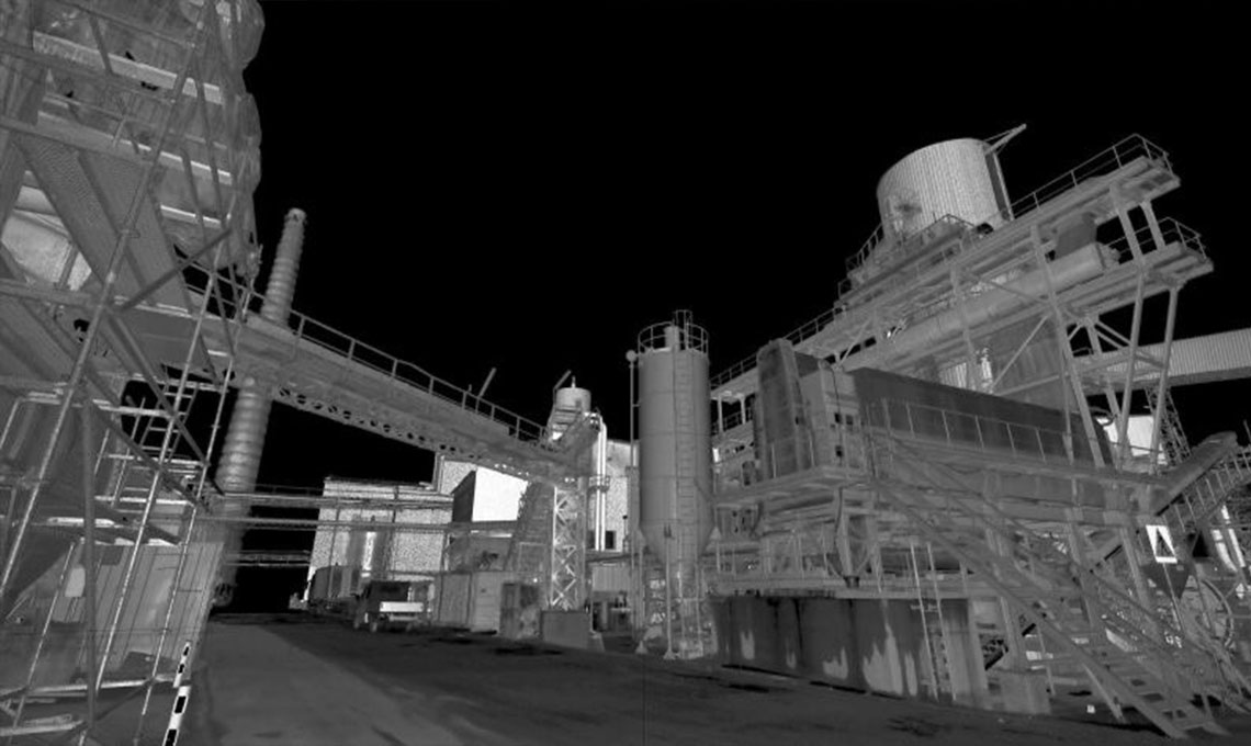
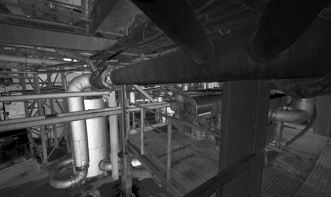
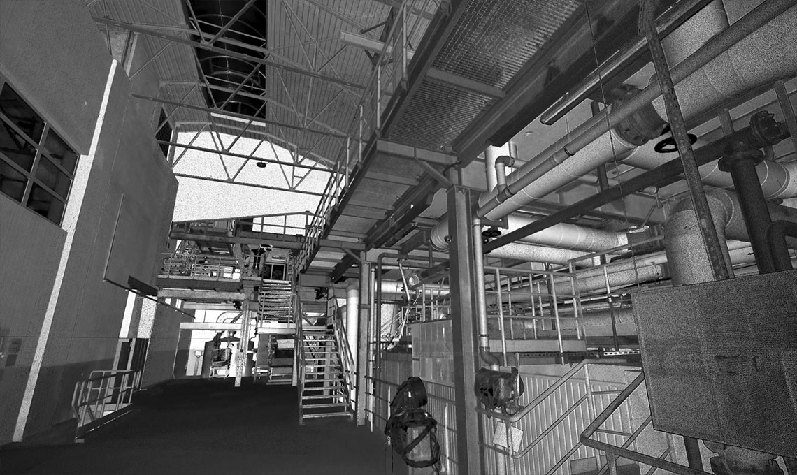
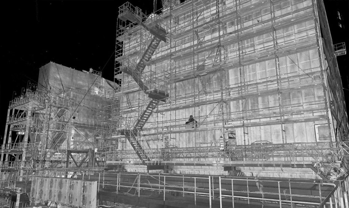
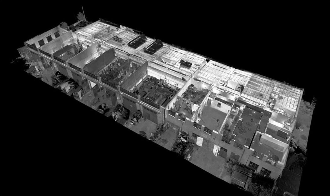
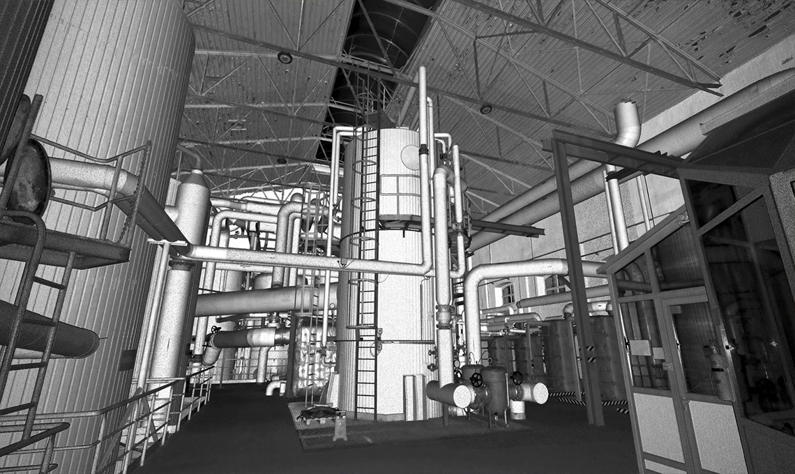
Point cloud model shows us the real physical shape of the objects in the area. This physical shape could be a small object or a huge industrial or constructional site. Point cloud models are mostly used in 3D modeling, they are the output result of 3D laser scanners and they contain millions of measured points from the exterior surface of the objects in the area. Point cloud model which is also known as “As built 3D model or existing situation 3D model” among the engineers all around the world is used for various purposes, such as creating 3D CAD models that is used for reverse engineering (reproducing the parts), geometric measurements in complicated areas, making as built models for industrial projects, also for the incarnation, render, animation, and bulk customization apps.
Point cloud 3D model is one of the most valuable data in the industry. Users can spend less time on site, gathering as built information, dramatically reducing project timescale and costs. Every detail information is available with high precision (Resolution Range up to 0.1mm) in a frame of user friendly software. 3D Point cloud model contains full geometrical information from existing situation. Applied 3D point cloud model would be placed instead of numerous hardcopy as built drawings. It lets owners to have electronic archive instead of traditional library. Alternatively, 3D as built point cloud model could be linked with all major 3D design packages including PDMS, Auto plants, Auto Cad Micro station, PDS and ....
We can run engineering detail design job through 3D point cloud files which has been achieved from field. Economic and wise decisions easily available. Besides that, even we can create dismantling drawings for some parts of existing situation that is needed to be removed for execution of new systems. Dismantling drawing is a new word in industry that has been mentioned to systematic planning and reducing the cost of execution of rebuilding and mending projects. By using the mentioned 3D model, checking feasibility and various measurements are possible without frequently site visiting. Consequently, designers can make most practical and optimized implementation decisions.
Industrial point cloud model/ Process areas point cloud model:
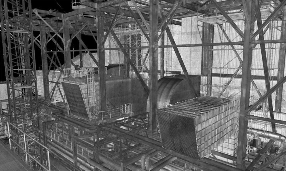
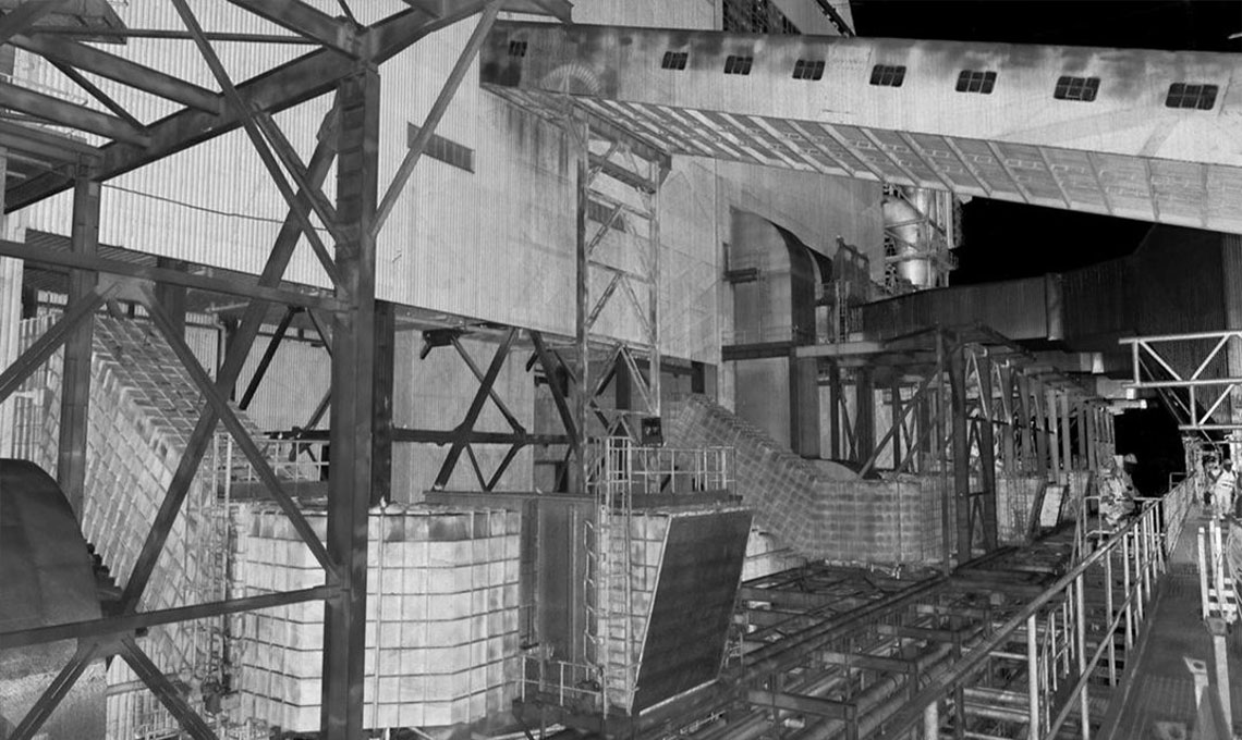
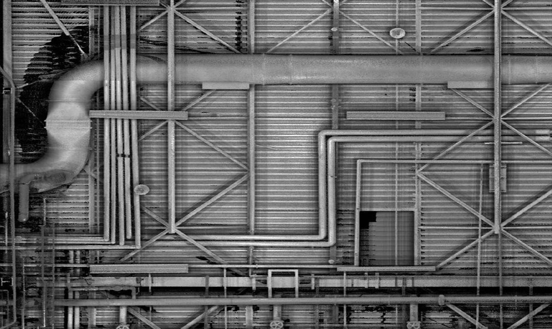
3D point cloud is a perfect combination of geometric information in an industrial area, every single physical object that has been captured during laser scanning has a specific X, Y, Z coordinates and with due attention to the definition of areas benchmark for laser scanners, every existing detail in the site gets its exact local/global coordinates. So that every distance in the point cloud is simply measurable. The manufactured 3D point cloud file allows us to measure all dimensions and geometric details of every physical object in the area such as piping, structure, equipment, electrical equipment and everything in industrial or non-industrial buildings and sites. As built model is also effective in development, renovation, and repair plans, beside its own all operational applications.
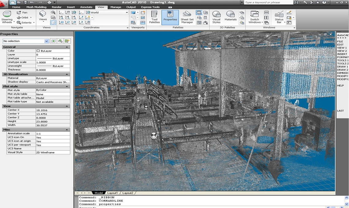
The generated 3D file is imported in the special software of the scanner and then prepared for loading in design and engineering software. By using the right software paths in transferring data, the produced model would be in a situation that users can move in the virtual space of the industrial complex. They could check the coordinates of various items in it, such as all items of piping network, electricity, instrumentation, buildings, structures, storage tanks, mechanical equipment and all other environmental factors. In terms of dimensions and geometry they would have absolute dominance over the situation. At the same time, using this model, it is possible for the user to easily measure the desired details and different distances of all physical factors in the area.
When you install LFM software in your device (laptop, computer,) you can capture various photos from the area with the shown measured distance in any dimensions. Also, you can compare these distances with the old traditional distances on paper plans. With teaching LFM software to the employee staff and giving them the certification, they will be able to create a new and modern archive for their corporation and this can be a serious step to forward for them. Unique panorama photos with the fantastic engineering features from the site that you can measure any distance or object in that space is another important feature of the point cloud, also any point coordinates is visible in the point cloud whether in UTM or LOCAL coordinates due to ask of the employee.
Benefits of 3D point cloud model
- High amount of restorable information in the form of 3D models.
- Maximum accuracy in dimensional measurements of industrial area and workshop conditions.
- High speed in collecting information.
- simple manner for collecting comprehensive and unique information in comparison with traditional methods
- direct cost reduction by predicting exact volume of work, needed materials and time schedules
- indirect thrifty by eliminating the cost of frequent visits of experts to the site
- Point Cloud data compatibility with all common 3D modeling software and possibility of using directly for engineering design purposes.
- Full review possibility between newly design models with the existing items in operating area. It means that we can avoid any kind of unwanted clash between various physical factors at construction.
- Prefabrication possibility and minimum hot work at the installation of equipment on sites.
- Computerized 3D models could be adjusted simultaneously with changes in environmental conditions.
- Point cloud model creates perfect axial data for constructive engagement in running projects between engineering departments
- 3D point cloud models have provided the possibility of abandoning maps and eliminating decisions based on two-dimensional idea and at the same time offered spotless data rotation within engineering teams
- Virtual walking or walk through in 3D dimensional scanned space has been provided.
- Higher safety for workshop personnel (by reducing the time spent in the exploiting areas and avoiding going to heights, etc.).
- fly over ability in three-dimensional status of the scanned area, exactly equivalent to the space of common three-dimensional models such as: PDMS, Auto Plant, etc., independent to the number of points taken in the workshop from angles and positions that random observer can never access.
- Point Cloud 3D model management software is LFM which is a quit user friendly and easy to learn.